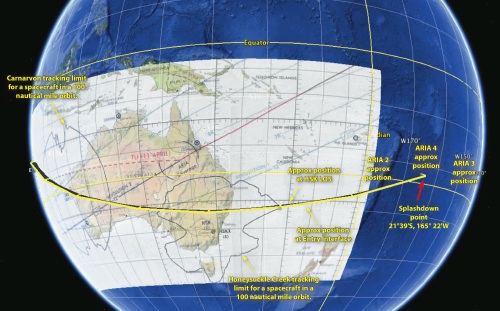
Apollo 13 Re-entry Groundtrack
Prior to re-entry, Apollo 13 travelled from east to west across Australia. As it sped up, it overtook the Earth as it spun below, and reversed its apparent direction, streaking across Australia from west to east.
The spacecraft’s track took it dircectly over Carnarvon, down into South Australia, passing just north of Broken Hill inside the border with New South Wales.
From there is passed close to Armidale, crossing the coast near Coffs Harbour. Once over the Pacific, Entry Interface was near Norfolk Island.
After Honeysuckle Creek had loss of signal, three ARIA aircraft were on station waiting for post-blackout acquisition: ARIA 2 was about 300 nautical miles up-track from the predicted splashdown point, ARIA 4 was near the predicted point, and ARIA 3 was about 300 nautical miles down-track, in case Apollo 13 overshot the landing target.
|
An approximate representation of Apollo 13’s re-entry groundtrack. Spacecraft elevation is not really reflected in this diagram.
Since the spacecraft was higher than 100 nautical miles during its pass over Australia, the tracking limits for Carnarvon, Honeysuckle Creek and Tidbinbilla, would have been considerably larger. In addition, it is believed an ARIA had staged from Darwin to cover Central Australia. More details if they can be discovered.
The groundtrack reversal (or foldback) occurred over the Indian Ocean, and is not depicted here.
Click the image to download a 490kb PDF file.
Hear Peter Pockley’s description of the groundtrack on Australian radio here.
|
|
Audio of the last track.
Hear the handover from Carnarvon to Honeysuckle Creek at the start of the last pass as Apollo 13 streaks across Australia.
Audio is from the Network Controller’s loop.
Mike Dinn responds to calls from TIC, Track, and other controllers in Houston. John Saxon responds to a question from TIC at 142:40:50 GET.
At Apollo in Real Time – link thanks to Mike Dinn.
Alternatively, hear the segment as an mp3 audio file (6.5MB)
|
|
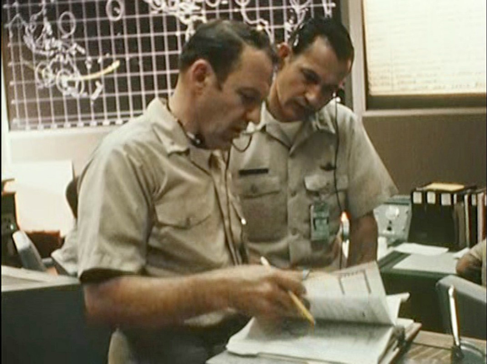
The photo was taken in the Houston ROCR; the Recovery Operations Control Room that was next to the MOCR.
The display in the background
on this photo shows the ground track of the Apollo 13 Command
Module during re-entry.
Click here for
an enlargement of the groundtrack chart.
Image found by Mike Dinn – this screenshot by Colin Mackellar from a brief film clip on the Spacecraft Films Apollo 13 DVD set. (With thanks to Tom Sheehan and Bill Wood for the ID of where this was taken.)
|
|
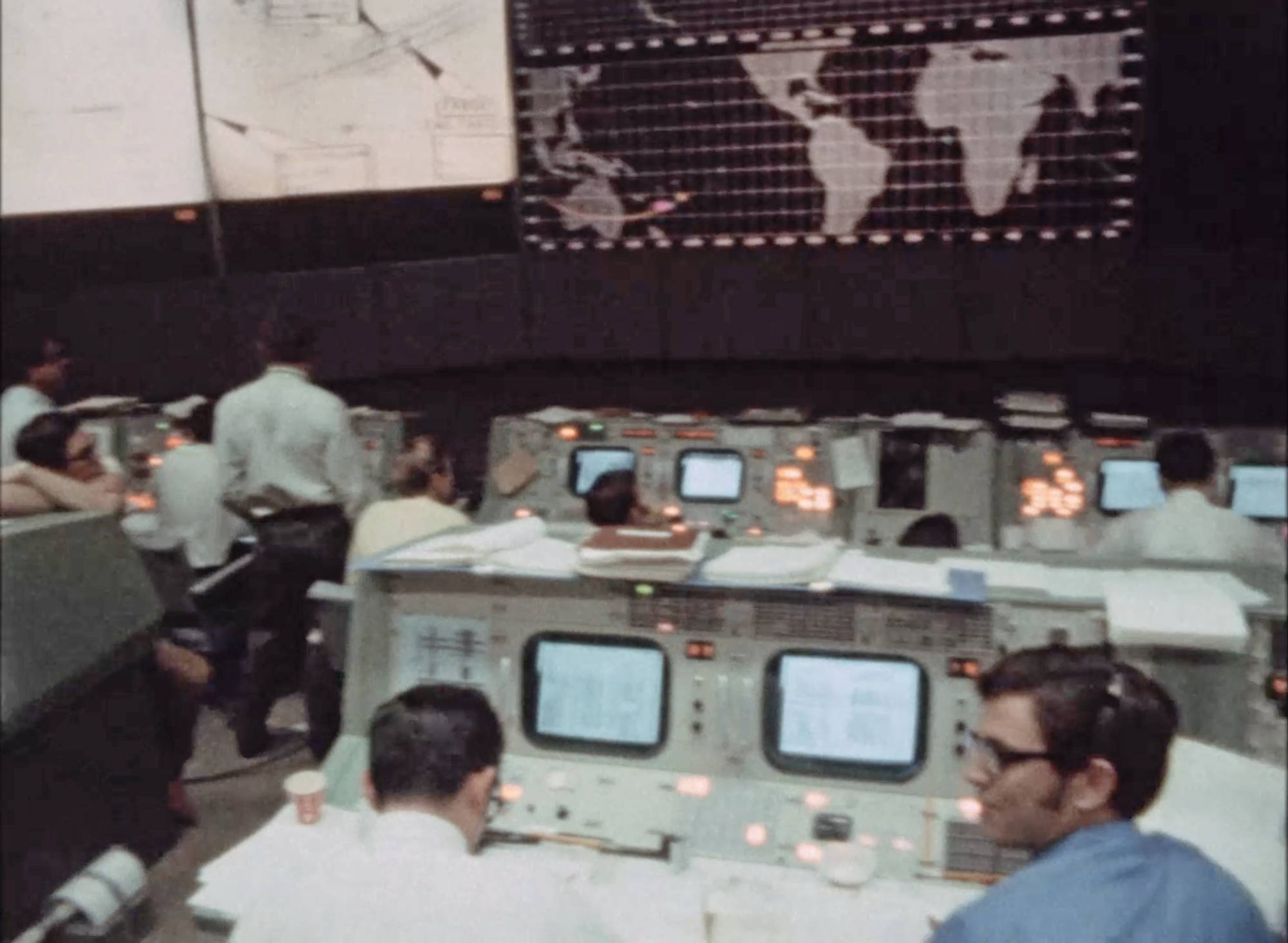
This frame from 16mm footage shows the scene in the Mission Operations Control Room during the Re-entry, with Apollo 13’s groundtrack across Australia displayed on the front centre screen.
Image courtesy of Stephen Slater.
|
|
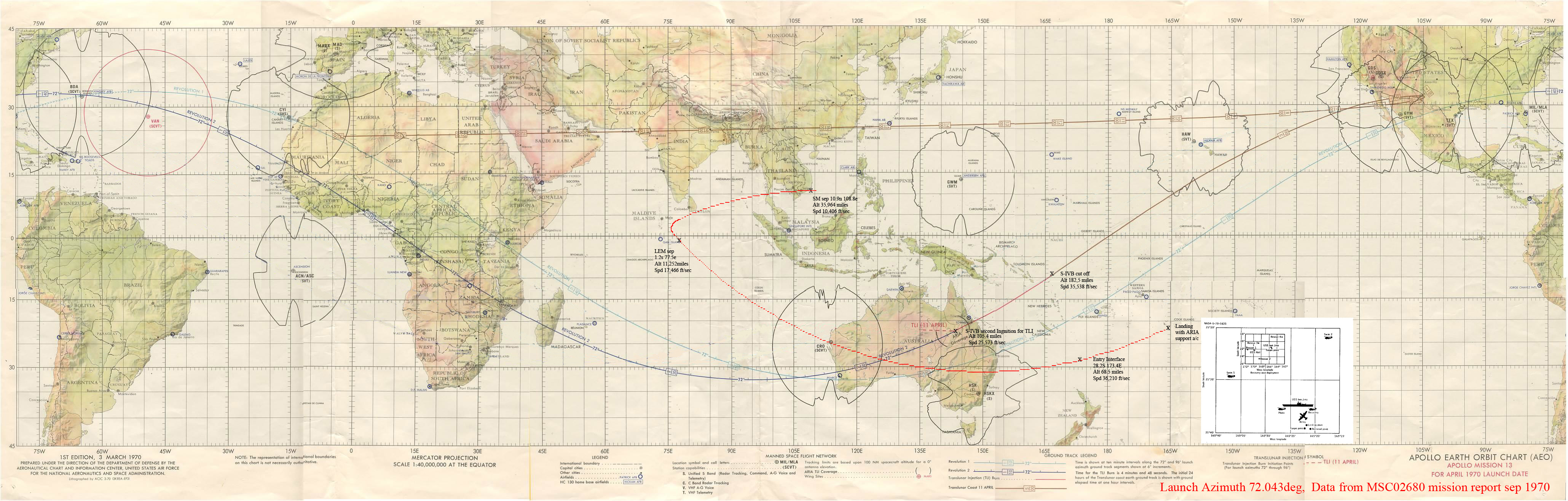
Harry Campigli has shared his representation of Apollo 13’s re-entry groundtrack.
While there is some guesswork involved, it gives a good idea of the ‘foldback’ or reversal of Apollo 13’s ground track as its increased speed towards re-entry reversed its direction with respect to the Earth.
Harry writes, “I have removed the tracks apart from 72° [launch azimuth] to make it clearer, also I have added positions from the NASA mission report of Sept 1970. Launch Azimuth was 72.04 and the TLI fixes line up ok. I am not too sure about the start the of return track, anything higher than the LEM separation is bit of a guess guided by the SM separation position.
From the LM separation point to splash I think might be ok, I picked up from the ABC recording that A13 overflew Armidale and Coffs Harbour and they fall in ok on the track.”
Click for a 1.2MB version.
|