|
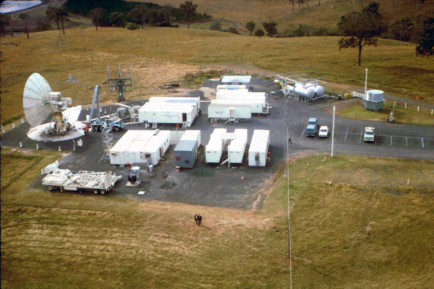
Cooby Creek Tracking Station
as photographed by Neil Sandford from the top of the 120 foot (37 metre) PMG link tower.
The tower was erected just outside the western boundary of the station to allow the relay of television for Expo 67, Our World and other early satellite television programming.
The Cooby Creek Reservoir is just visible at top left
about 700 metres away.
Large, Larger.
(Image cleanup by Colin Mackellar.) |
The Applications Technology Satellite Ground Station at Cooby Creek was built near the southern shore of the Cooby Creek Reservoir, about 22km north of Toowoomba, in Queensland’s Darling Downs.
Cooby Creek was a ‘Transportable Ground Station’ and was only ever intended to be used in Australia for a limited time. Its purpose was to support the pioneering work of satellite communication and weather forecasting, using the ATS series of satellites.
Before the station was closed and moved out of Australia in 1970, Cooby Creek had allowed Australians to see live satellite television for the very first time.
The other two stations to support the ATS Program were Rosman, North Carolina (PDF file), and Mojave, California.
It appears NASA’s initial desire had been to site the Australian station at Woomera (Woomera is mentioned as late as May 12, 1966, in the Goddard Operation Manual for the station, OM-533-5, page 1-3.).
The remoteness, and associated costs of Woomera, as well as the mooted closure of DSS41 Island Lagoon, apparently led NASA to consider siting the station in the Australian Capital Territory, to benefit from the proximity of Canberra, as well as the Tidbinbilla, Orroral Valley and Honeysuckle Creek Tracking Stations. However the planned TGS would operate in the frequency band already assigned to the Melbourne – Canberra – Sydney radio relay link. For that reason, the station was built in a radio-quiet area north of Toowoomba.
The station was opened on 22nd October 1966.
Jack Watson estimates the USB antenna base was at 27° 23' 44.75" S, 151° 56' 19.65" E.
|
Cooby Creek Tracking Station location map.
Department of Supply map. |
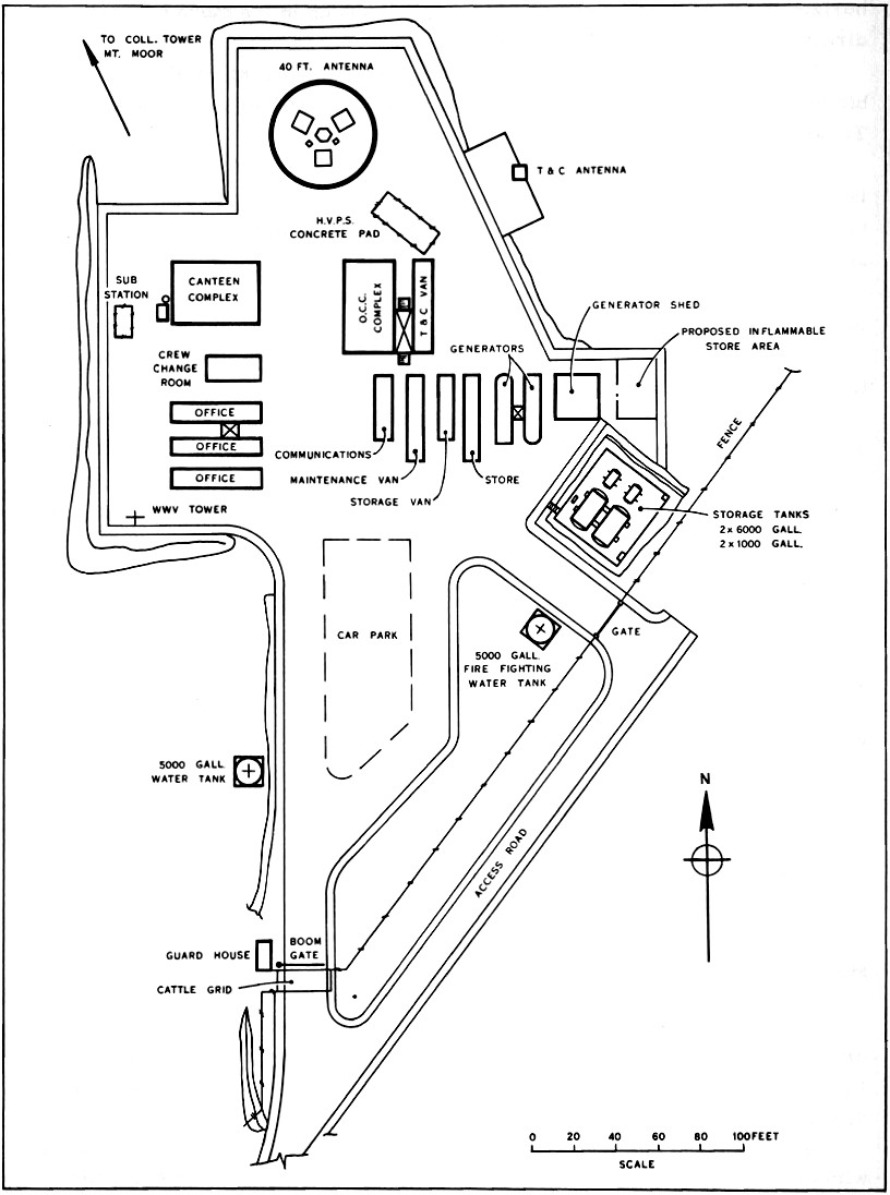
|
Cooby Creek Tracking Station layout.
Department of Supply. |