STF18 (Satellite Tracking Facility 18)
The first US satellite tracking system, called Minitrack, a part
of Project Vanguard, was designed by the US Naval Research Laboratory. It was
installed at Woomera Range G to the North of Woomera village
in 1957 and became operational in March 1958.
The equipment, excluding fixed and steerable antennas, was housed
in an air-conditioned Fruehauf semi-trailer. It tracked satellites which transmitted
on 108 MHz.
The Department of Supply staffed that Station under Jack Dowling. (Jack was later Station Director at MILA – the Merritt Island Launch Area tracking station.)
When the next generation of earth-orbiting satellites
began using a frequency of 136 MHz and, to service them, the station was relocated
to Island Lagoon. The system was upgraded to the Mod. 1 Minitrack of 136 MHz
and a permanent building and new Minitrack equipment were installed.
This 136 MHz equipment is what is shown in Bruce Window’s
photos.
When Island Lagoon closed, the Minitrack system was moved to
Orroral Valley Tracking Station
near Canberra.
(with thanks to Bruce Window.)
|
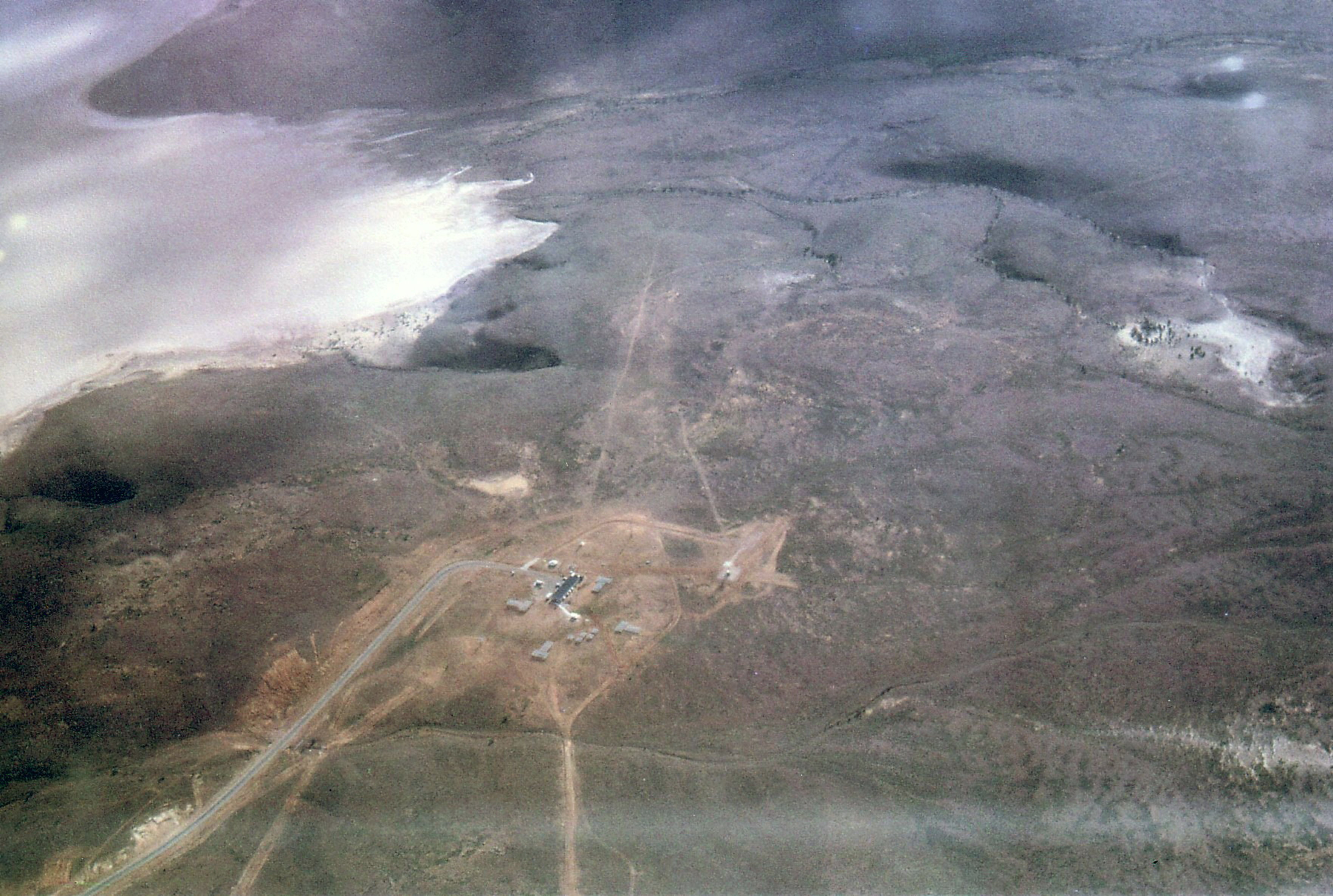
Island Lagoon Minitrack 1964.
Jan Delgado took this photo (and another of Woomera township) from an aircraft on the way to/from Adelaide.
|
Minitrack – then and now |
|
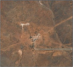 |
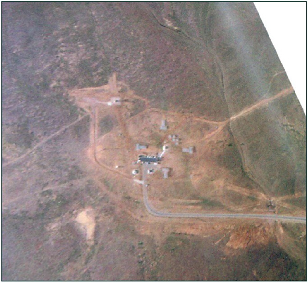
Island Lagoon Minitrack 1964 and contemporary views.
At left, Jan Delgado’s oblique aerial photo of the Minitrack site has been ortho-corrected so that it approximately corresponds to the contemporary satellite view (right, courtesy of Google Earth). North is at the top.
Click each image for a larger version
|