In August 1962, a NASA site survey selected a radio-quiet valley 10 air miles from Canberra, in the sheep and cattle grazing lands of the Tidbinbilla Valley
In March 1963, NASA and the Australian government agreed to lease 150 acres to accommodate a 26 meter antenna and other tracking and support equipment.
|
Before Tidbinbilla – 31 July 1963.
A WRE Volkswagon fords Paddy’s Creek on what is now known as Discovery Drive – the road from the Paddys River Road to the station.
Even at this stage, long before construction starts, it is obvious there has been a fair amount of traffic.
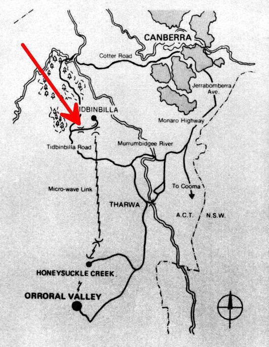
Location on the map below, from a 1978 Orroral Valley leaflet.
WRE photo MF/19/8A. Photo preserved by Hamish Lindsay. Scan and ID by Colin Mackellar.
Mike Dinn contributes,
“When I began [at Tidbinbilla in February 1966], work had just started on the sealing and improving of the road from the Cotter to the Tid turn off. Paid for by NASA.
I once drove Ian Homewood and Buzz Brockett to Tid. Buzz said ‘We paid for this road’, but Ian said ‘We paid for the fencing!’ (the original road was unfenced).” |
 |
|
The same spot on Discovery Drive, 01 December 2017.
The crossing is much easier these days!
Photo by Colin Mackellar. |
|
Before Tidbinbilla – around the same time, July 1963.
In this view from Larry’s Hill, the road is being bulldozed up to the site. Tracks can be seen, apparently building a crossing over Larry’s Creek, at centre of the picture.
Photo preserved by Hamish Lindsay. Scan and ID by Colin Mackellar. |
|
Detail from the above image.
The man on the right is WRE’s Howard Loxton. Can anyone identify the man on the left? (Contact.)
Photo preserved by Hamish Lindsay. Scan and ID by Colin Mackellar. |
|
Before Tidbinbilla – same day.
As the camera pans to the left, we can see a bulldozer creating the road into the site. It’s travelled as far as the location of the current CDSCC Visitors’ Centre.
Photo preserved by Hamish Lindsay. Scan and ID by Colin Mackellar. |
|
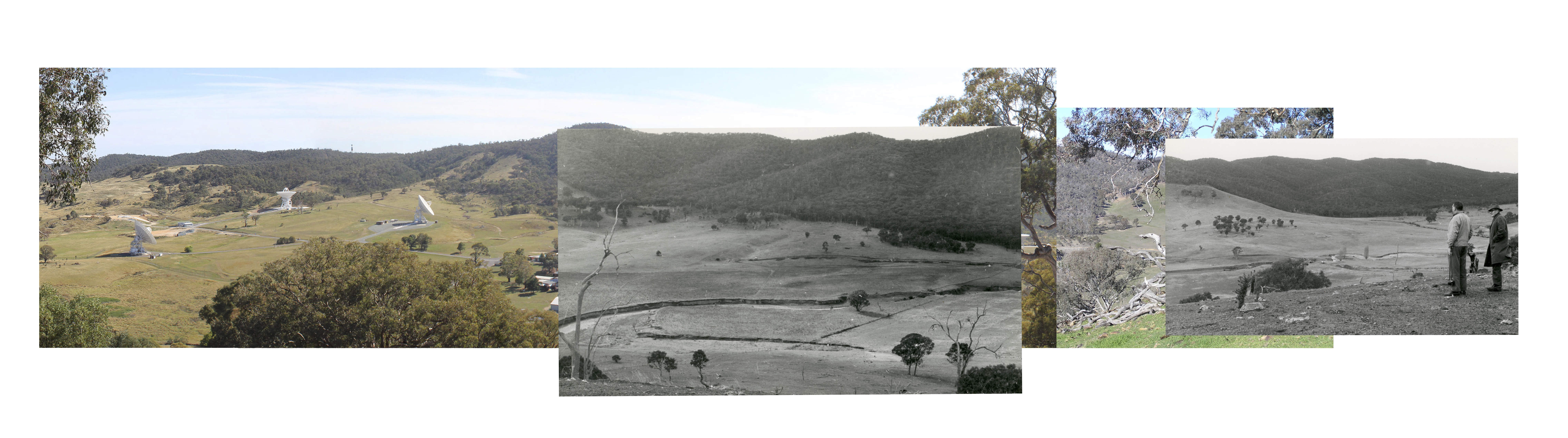
A 2015 view with the above photos superimposed.
Since the photos 52 years apart were not taken from the same spot on Larry’s Hill, they don’t line up as well as might be hoped – but you get the idea.
Comparison produced by Colin Mackellar. |
|
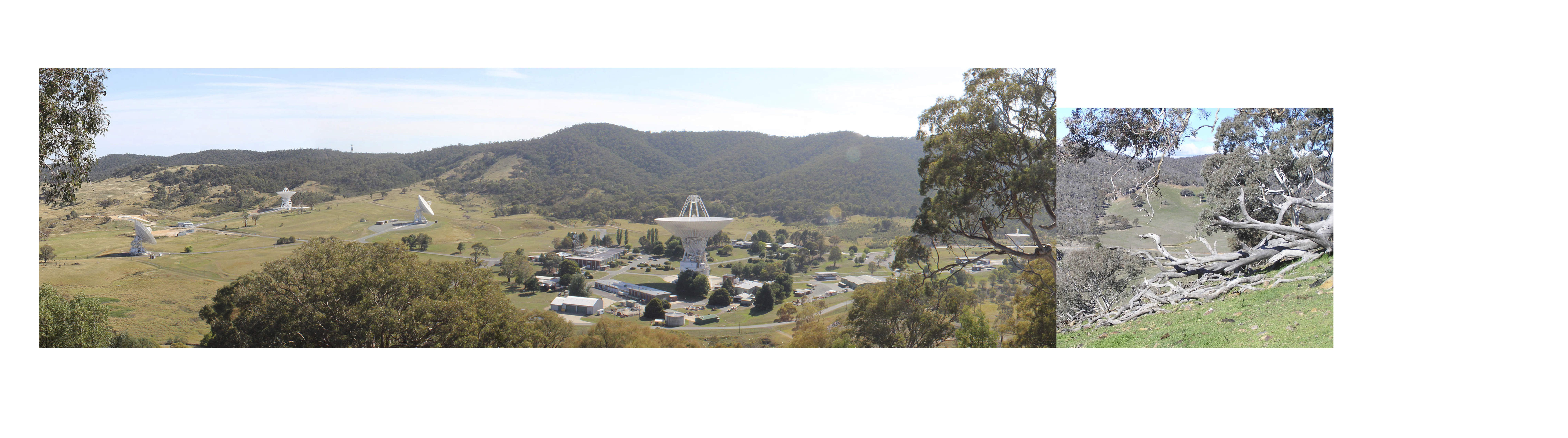
The 2015 view from Larry’s Hill. Photo: Colin Mackellar. |
|
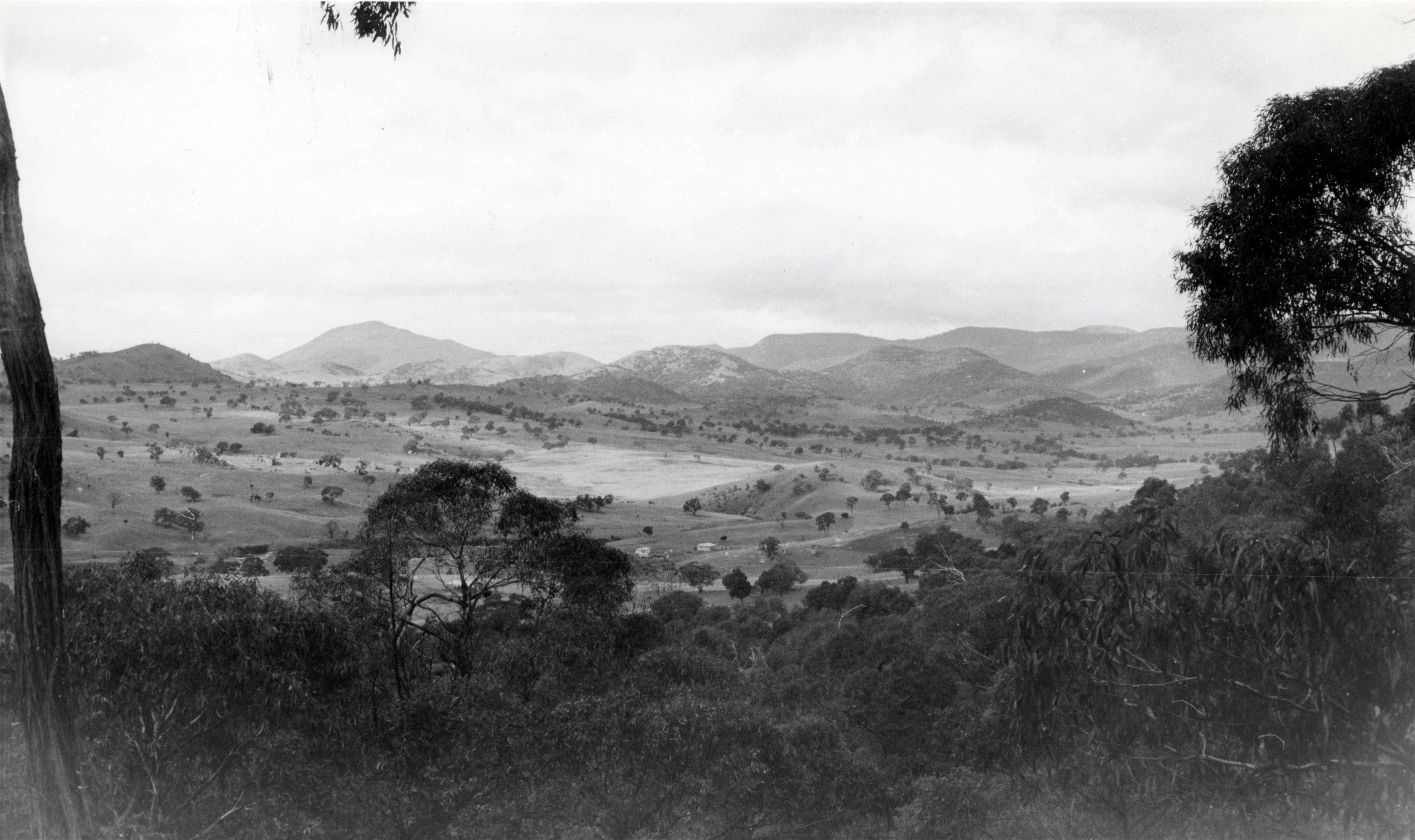
Before Tidbinbilla – July 1963.
In this view from Larry’s Hill, the WRE photographer has turned to the right – facing roughly SW to W – to see the access road (now Discovery Drive).
In the distance – just to the right of the access road and Paddys River Road, the Flints’ homestead, “Congwarra” can be seen.
Photo preserved by Hamish Lindsay. Scan and ID by Colin Mackellar. |
|
Before Tidbinbilla – July 1963.
Here’s an annotated version of the photo above.
Photo preserved by Hamish Lindsay. Scan and ID by Colin Mackellar. |
|
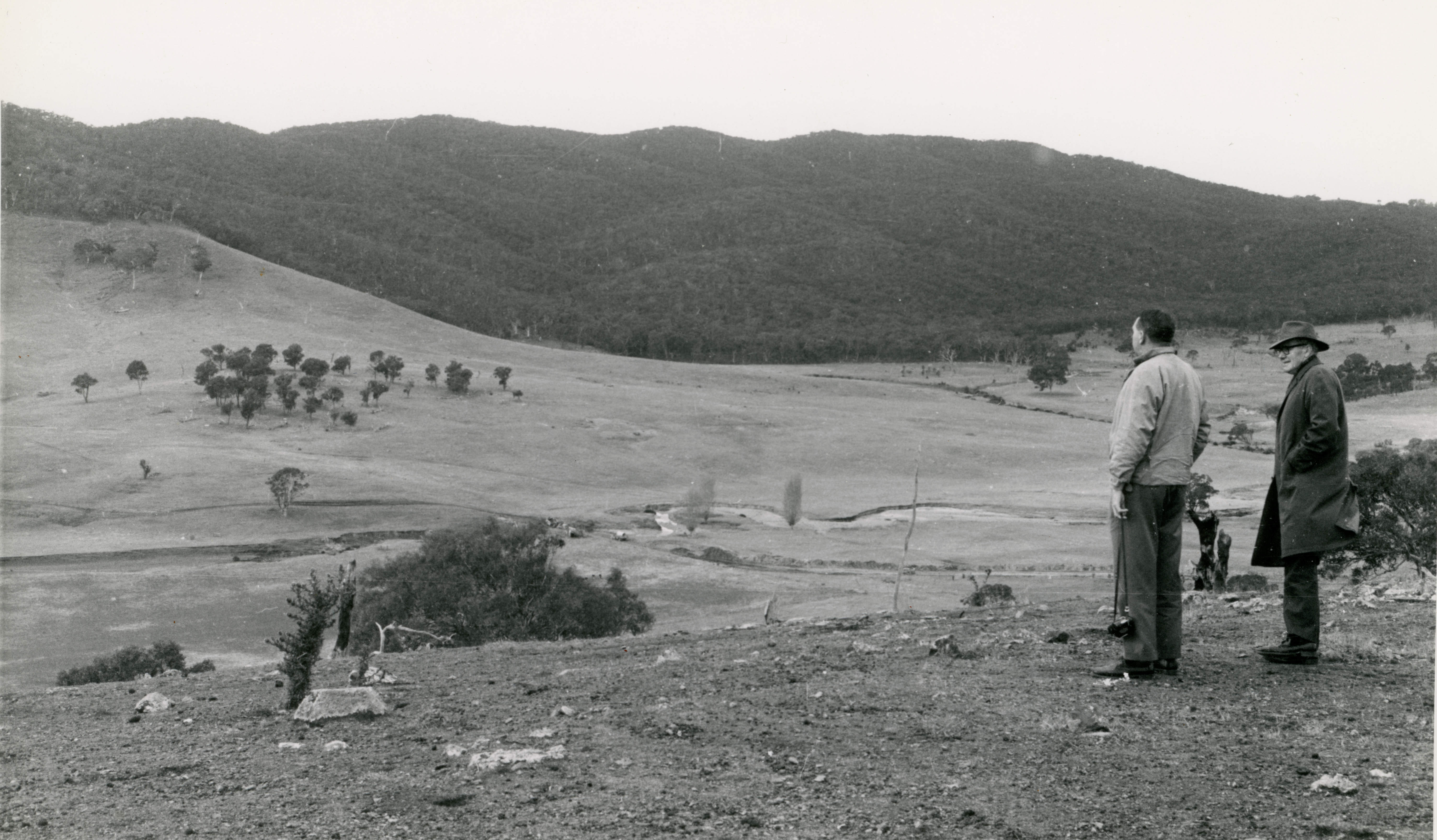
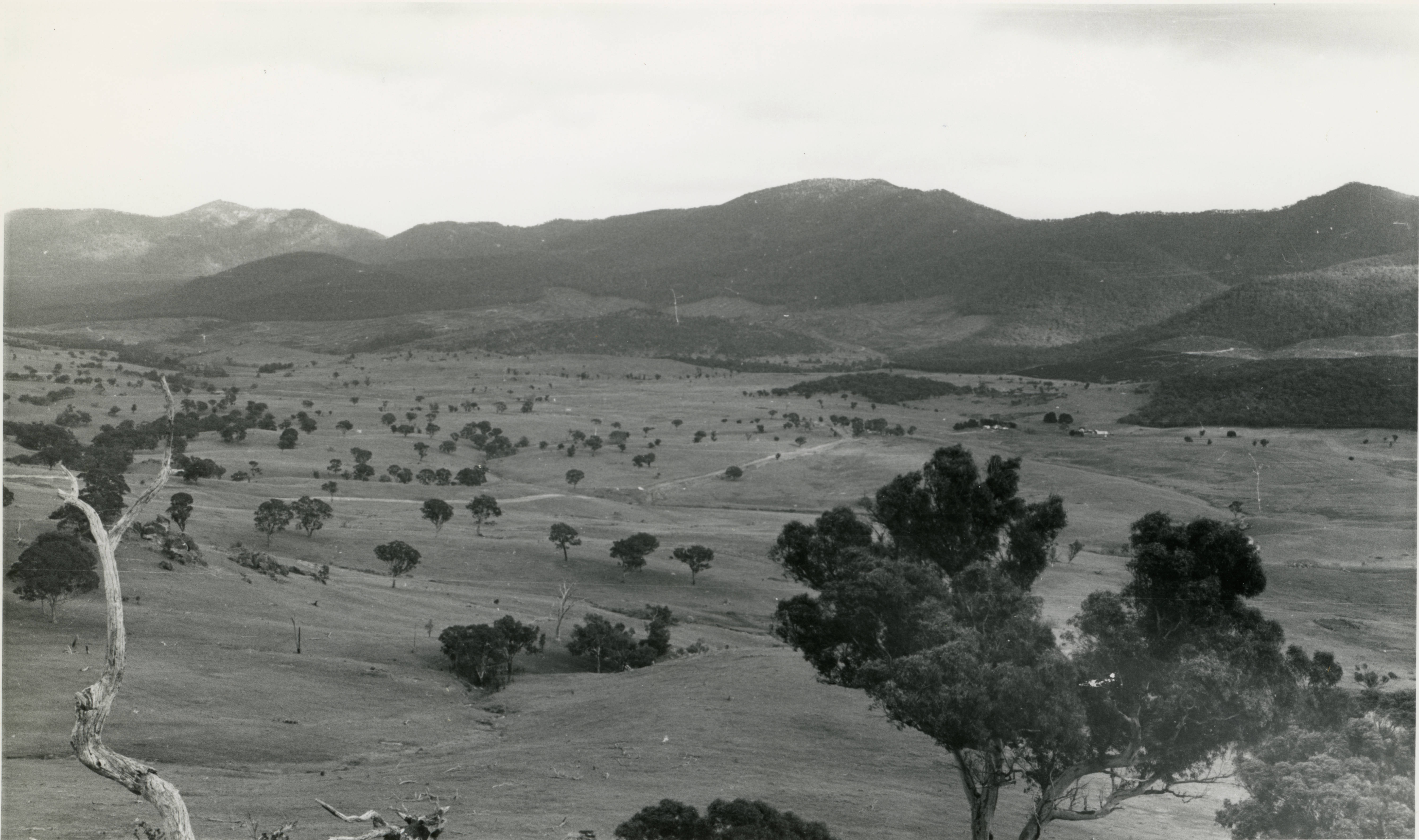
Before Tidbinbilla – July 1963.
This view seems to be from the collimation tower site – or somewhere nearby (though I am not certain) – looking roughly south. If so, Tidbinbilla would but just out of frame to the left.
Photo preserved by Hamish Lindsay. Scan by Colin Mackellar. |
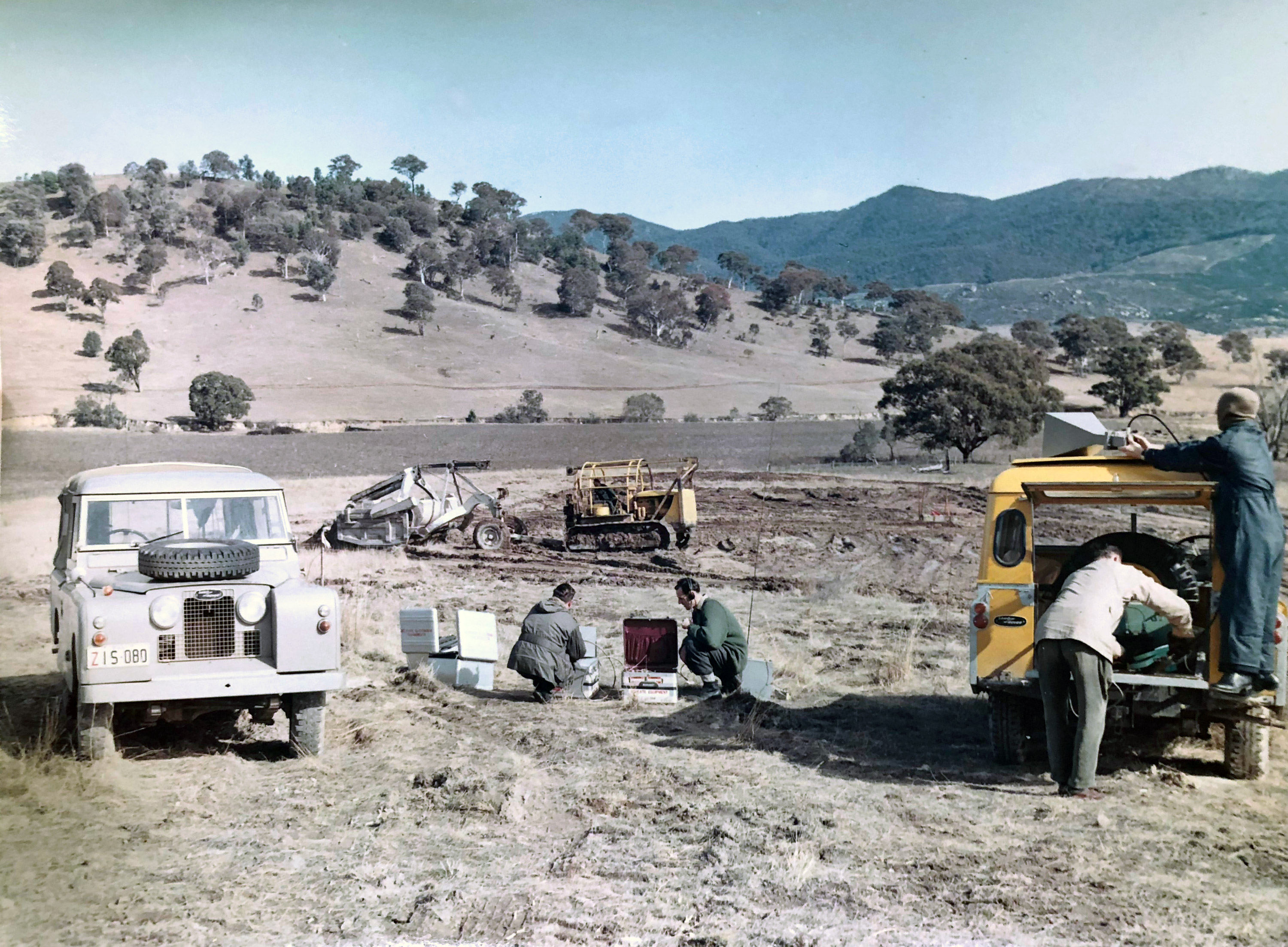
Before any construction began, work was done to ensure that the site was free from radio noise at S-band frequencies.
|
Before Tid – 7 August 1963.
The photo shows Keith Brockelsby (right) and Jeff Newnham operating a sensitive S-Band JPL receiver at the proposed Tidbinbilla site, measuring isolation at S band from an S band transmitter in Canberra.
With thanks to Jeff Newnham for the photo and text. |
|
Before Tid – 7 August 1963.
This view puts the above picture in context. The text on the back says, “Tracking Station, Tidbinbilla, looking SW toward Larry’s Hill from proposed site for antenna.”
Keith Brocklesby adds,
“Jeff Newnham and I carried out RF attenuation measurements on the proposed antenna site to ensure that radio noise from Canberra City would not pose a problem. [Most of the time] our only companions were a few grazing sheep!”
Photo courtesy the Tidbinbilla archives. Copy by Colin Mackellar. |
|
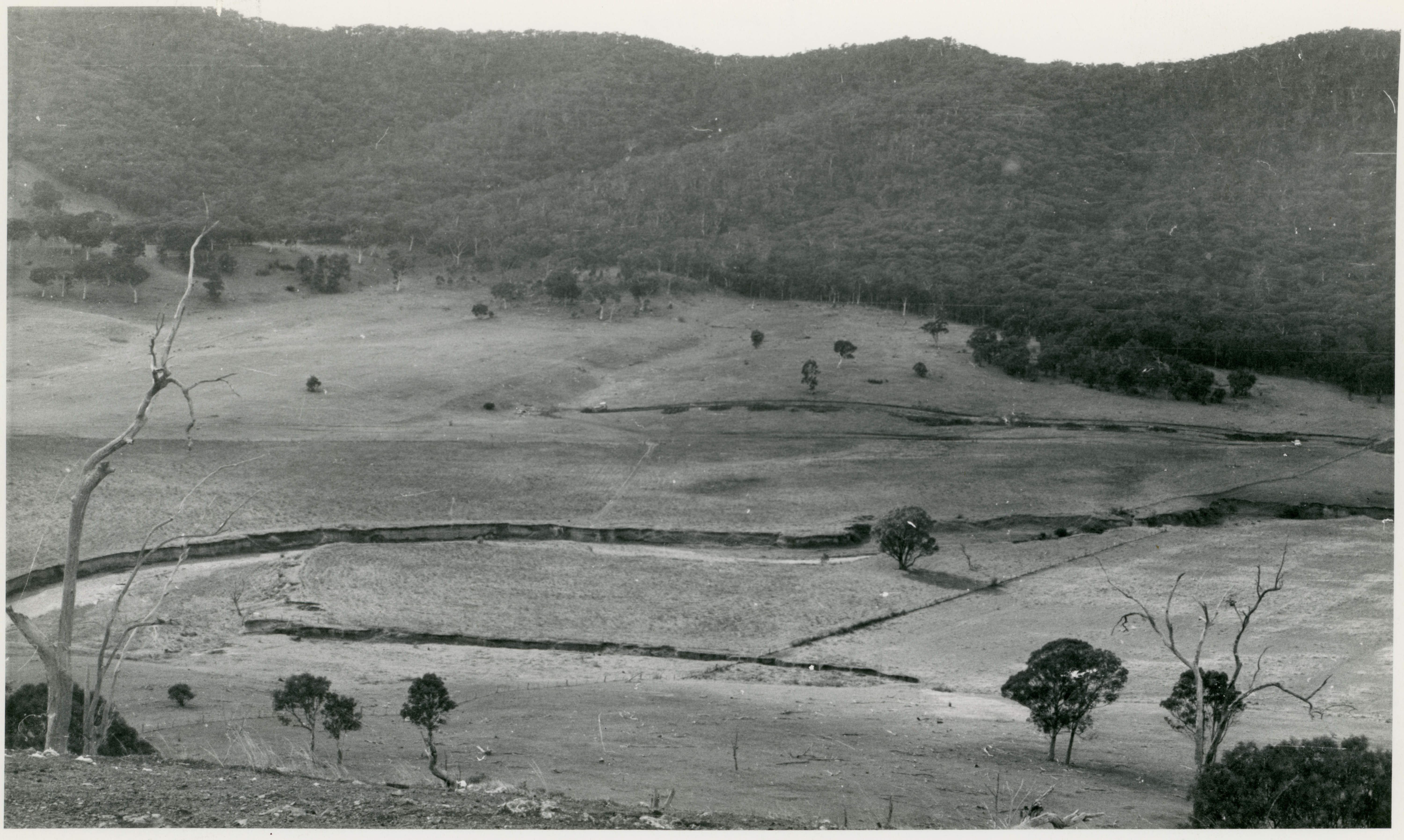
The Tidbinbilla site before construction, looking roughly west north west – the same view as that above, but further back.
The hill, “Larry’s Hill”, now has a water tank, and many views of the station were taken from there.
Large, Larger. Photo via Mike Dinn. |
Bob Leslie, the inaugural Station Director of Tidbinbilla writes:
“An area of 364 acres was withdrawn from the lease of Mr N. Reid’s Oakey Creek Station (now Mr Harding’s Mulumba Station) for the site and the access road to the Tidbinbilla Road was made through the Congwarra Station of Mr W. Flint.
An area of about 29 acres was fenced as the inner site of the tracking station and the remainder was returned to Mr Reid for agistment.
|
Inaugural Station Director Bob Leslie (centre) chats with an unidentified group (a note on the back of the print indicates they are Station Directors) over a BBQ lunch in this WRE photo taken on 20th August 1963.
It was apparently taken at the Tidbinbilla Nature Reserve.
Photo from the Tidbinbilla Archives. WRE ID MF63-23-26.
Updated 2024 scan: Colin Mackellar. |
A contract for maintenance and operations services at the station was let to Space Track Pty Ltd in early 1963. This company was a consortium of de Haviland, Elliots and Associated Electrical Industries (AET), formed for the purpose of the contract. Stan Joiner of de Haviland managed the contract for the consortium and John Galbraith was the company’s senior representative for carrying out the task under the contract.
The design of the facilities for the station was undertaken by the ACT Regional Office of the Commonwealth Department of Works. Bob Irvine was the project engineer and George Dunlop was the architect.
Basil Monckton and Lance Sharpe of WRE and Mel Glenn of JPL, worked with the Department of Works on the specification and acceptance phases of the construction.
The contract for construction of the buildings, the power house and other facilities was let to A.V. Jennings on 1 July 1963. The attractive buildings, basically as we know them today, were completed within one year.
|
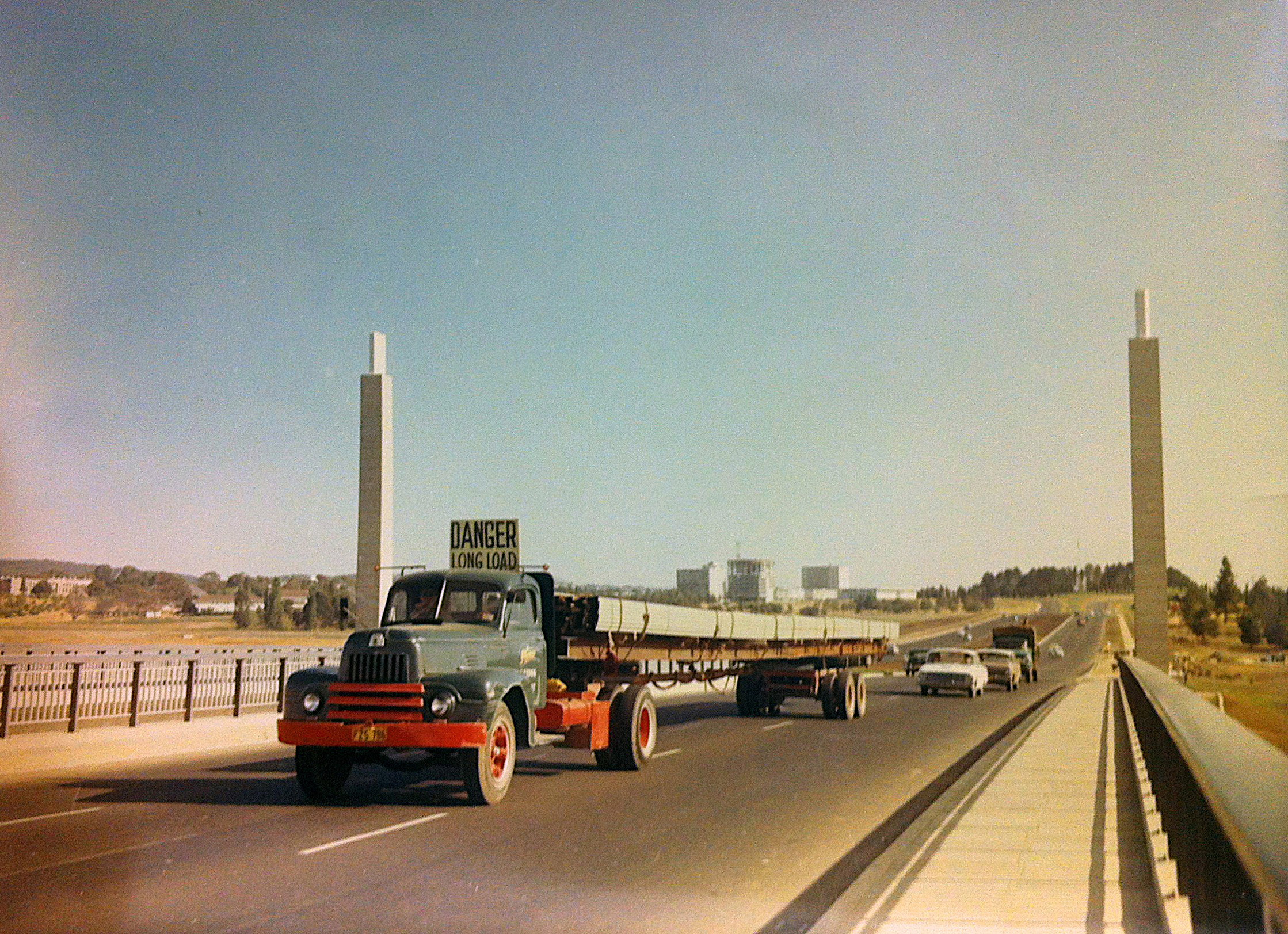
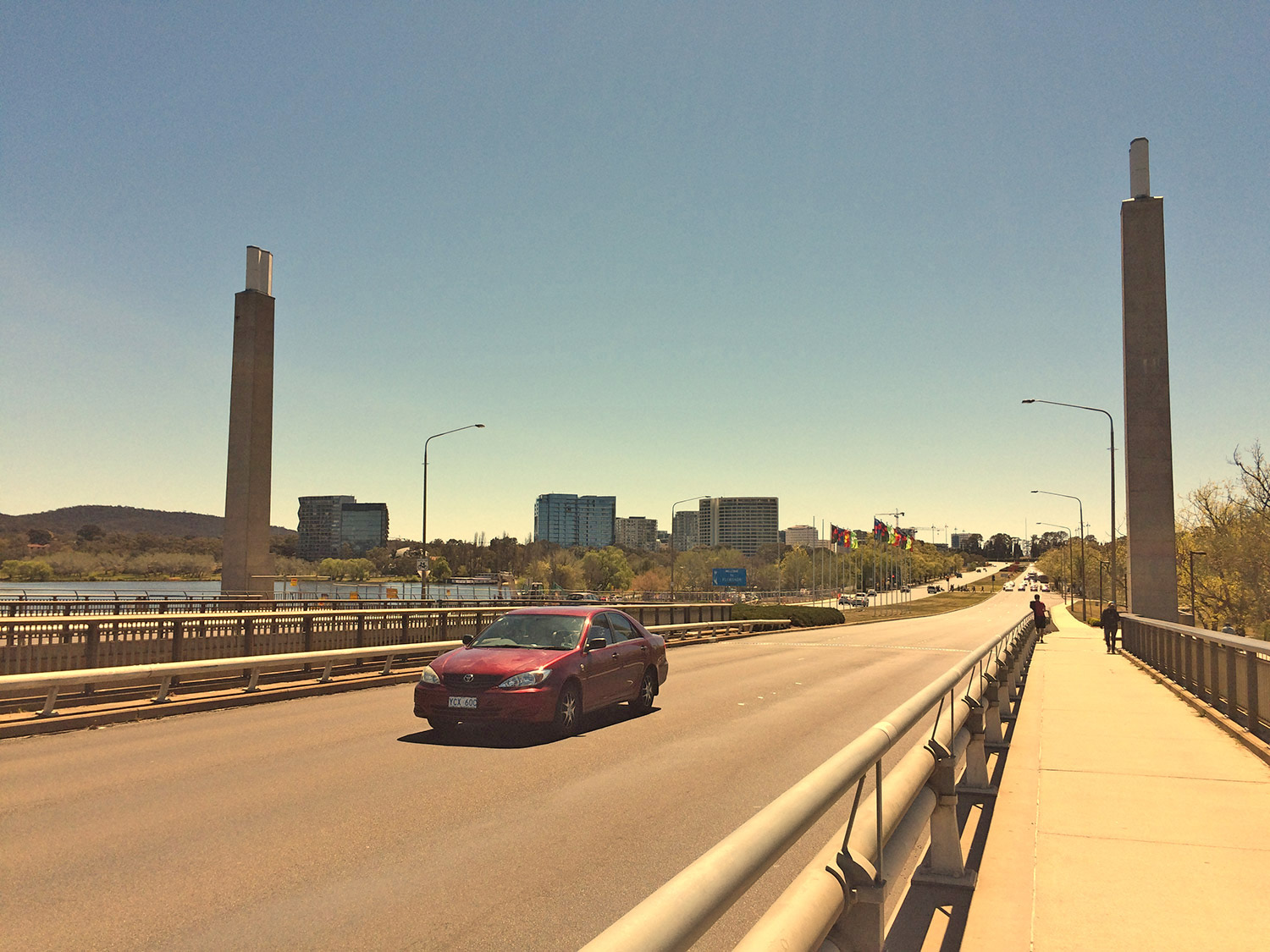
This truck heading for Tidbinbilla, possibly transporting steel girders for the Operations Building, crosses Commonwealth Avenue Bridge, heading south.
Likely taken in late 1963, Lake Burley Griffin had not yet been filled.
Undated photo from the Tidbinbilla Archives. Scan: Colin Mackellar. |
|
For comparison, here’s the same view in September 2017. |
|
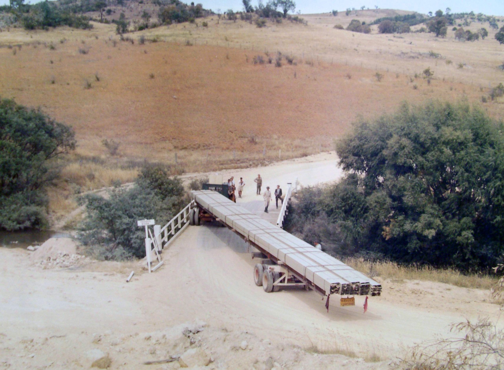
This seems to be the same truck in the photo above.
Dick Collins, from the Department of Supply, took this photo of problems at the Paddys River crossing, probably late 1963. Some of the railings on the right hand side of the bridge have had to be removed.
That difficult bend has now been removed, but the path of the old road is still visible in 2015 on the satellite imagery on Google Maps.
(Latitude, 35.461161°S, 149.021081°E.)
Large, Larger. Photo and scan: Dick Collins. |
|
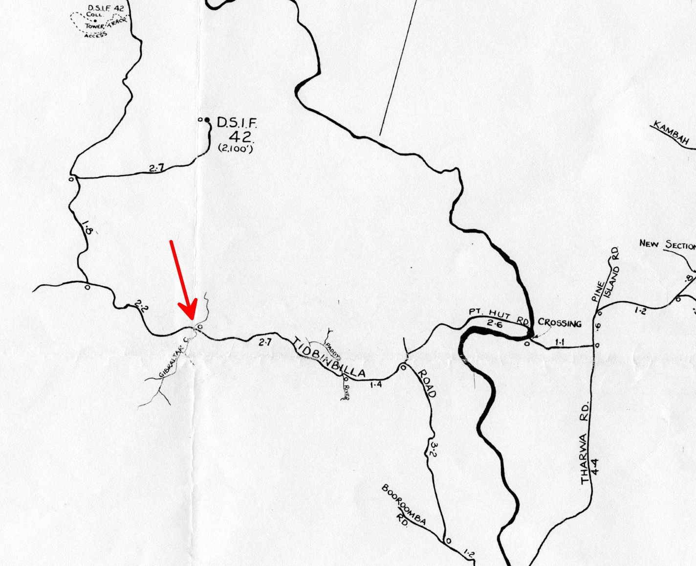
Here’s the location of the above photo – detail from the 1965 map below. |
The driving force for the hurried establishment of the Tidbinbilla Station was the need for additional support for NASA’s rapidly expanding deep space programme. In particular NASA needed support from our longitude for the first probe to Mars; Mariner 4, in late 1964, while still supporting the Ranger lunar exploration project from the Island Lagoon Station at Woomera.”
|
This October 1965 WRE map shows the locations of the three NASA tracking sites in the Australian Capital Territory.
It was produced for WRE by Richard (Dick) Collins, who participated in the site surveys for Honeysuckle Creek and Orroral Valley.
Orroral Valley is marked as DAF – i.e. Data Acquisition Facility.
Also marked are 41 Jardine Street, Kingston, a Department of Supply Office, and Endeavour House, on the corner of Canberra Avenue and Captain Cook Crescent, Manuka (the main Department of Supply office).
Red text added to this small preview.
With thanks to Dick Collins. Scan by his daughter, Jo Allen. |
References: Quotes from Bob Leslie, from his chapter “Space Tracking Stations”, written for the publication, “Canberra’s Engineering Heritage”. Other information from “A History of the Deep Space Network” by William Corliss, 1976 (NASA CR-151915).